Here's the set-up, explained graphically:
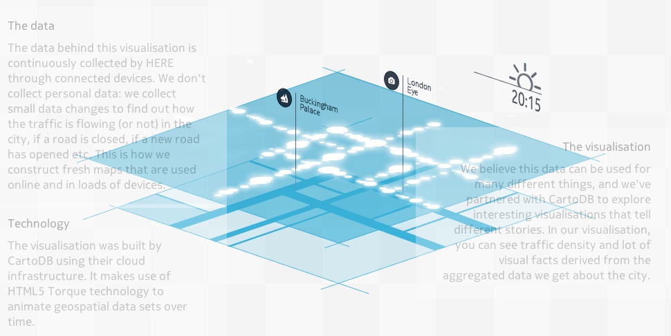
So essentially anybody using HERE Maps/Drive to navigate is invisibly also sending back data points to Nokia (only position is logged, nothing personal is kept, according to Nokia) and all it then takes is a little clever software and some graphical skills to come up with fancy animations like the one below. Here's London coming alive in the morning - it's a static screenshot, so you'll have to click through to the HTML5 animation on the Living Cities site to see the full thing:
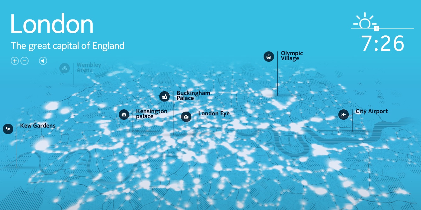
You can zoom in by using the controls given or by clicking on an icon - see if you can spot roads and junctions that you know well!
Right, Nokia, now roll this out for data from your systems across the world, please.