From the Android Police article:
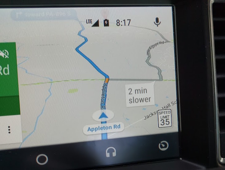
For years, Google Maps didn't support speed limits at all, a massively helpful feature on any navigation software. This finally changed last year, when the speed limit began to appear on Maps for Android Auto (and later the phone app). But it hasn't been available everywhere, and now Google has finally confirmed which areas have the feature.
According to a post on the Android Auto support forum, the speed limit indicator is only live in the San Francisco Bay Area and Rio de Janeiro, Brazil. Testing the feature in the Bay area makes sense, considering the close proximity to Google's Mountain View headquarters, but Rio is a bit of an odd choice. Perhaps Google's Brazil branch already had speed limit data on hand.
The post also says that Google is working to roll out speed limits to more areas, but there's no telling when. As much as I'm annoyed that I can't see the current speed limit on Google Maps in my area, it's understandable why. Google has to ensure it has the correct data for each area, or users could face speeding fines from following incorrect information.
In terms of keeping legal on the roads then, HERE Maps and Windows 10 Maps has about another year of this feature being exclusive, I estimate. Google has the resources to gather and roll out this function in their applications, given time.
It's frustrating that Windows phones have the full speed limit system built-in for most countries and Android phones have the real time traffic, but at the moment, mid-2017, you'd need two smartphones to have both functions! Unless you live in SF or Rio, of course!...

