Although Microsoft has claimed that the change is to make 3D images in Maps "simpler and prettier", the more likely explanation is that the licensing of the old HERE Maps models is about to lapse and Microsoft wants to get everyone transitioned over to using native Microsoft 3D data. There's more of this, mind you, and at a reduced byte size per country because there are less 'fancy' textured bits of detail.
The changes are striking, visually. (If you're wondering how I got to the views below, the trick is to either tap on the 3D/perspective control on the right side toolbar or to use two fingers to swipe up and down on the normal top-down 2D display.)
From my own home town of Reading in the UK, with the old/production Windows 10 Maps v5.1611.3342 on the left and v5.1611.10392 on the right:
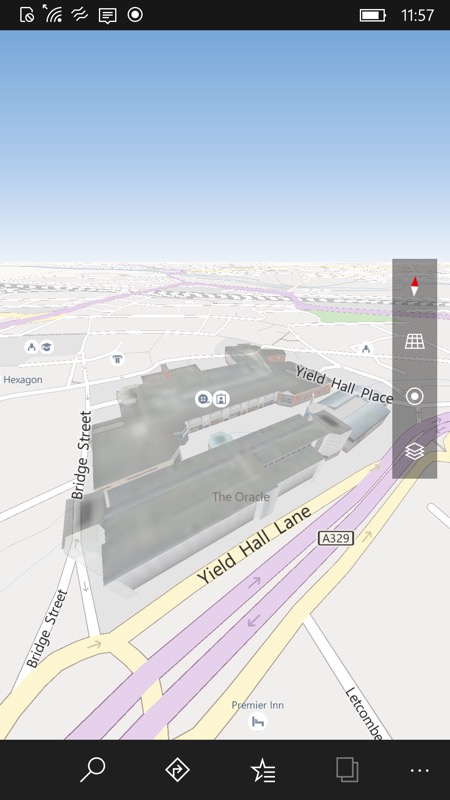
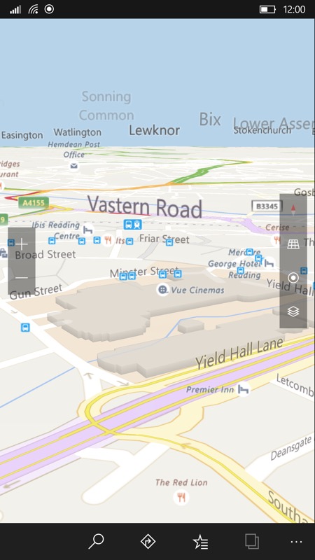
A striking difference, with more points of interest and transit stops, but much simpler vector 3D extrusions...
Hopefully you'll see similar improvements in 3D vector coverage and points of interest/context in your own town and country? Comments welcome. Even if this was sparked by HERE licensing lapsing, the end result is more things for us to look at in more places and with less space taken up by offline maps. So a net gain overall?
(thanks, Massis)