The app works by using the phone's on board sensors (GPS, compass, gyroscope and accelerometer) to determine the device's current location and orientation. In the augmented reality view place information (labels) is overlayed on a live view (what the camera is currently seeing).
The idea is that you hold the device up in front of you and pan around, using it to find or identify nearby locations. The application allows you to filter the place shown by category, and, if necessary, will cluster places together, in order to keep the amount of information displayed on screen to manageable levels. A radar like overview is displayed in the top right hand corner of the screen, which gives a rough idea of the number of nearby places and their orientation.
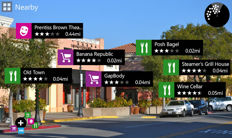
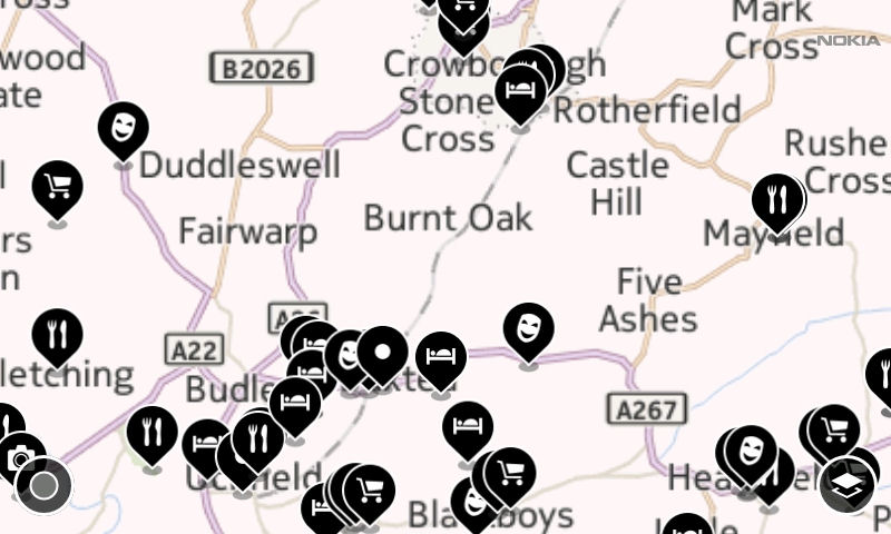
What's particularly clever about the City Lens app is that the view type changes depending on how you're holding the phone (again uses the on board sensors to detect this). The augmented reality view is displayed when the phone is held up (i.e. at 90 degrees to ground level) in landscape orientation. When the phone is in landscape orientation and facing down (i.e. towards the ground) the map view is displayed, essentially giving a birds-eye-view of nearby places. And if the phone is held in portrait orientation then a list of places (sorted by distance) is shown.
Switching between these three views feels very natural, following the likely pattern of user behaviour (look up to identify places in direct sites, look down to see map of nearby places). App performance is also impressive, with a near instant switch between the augmented, map and list views.
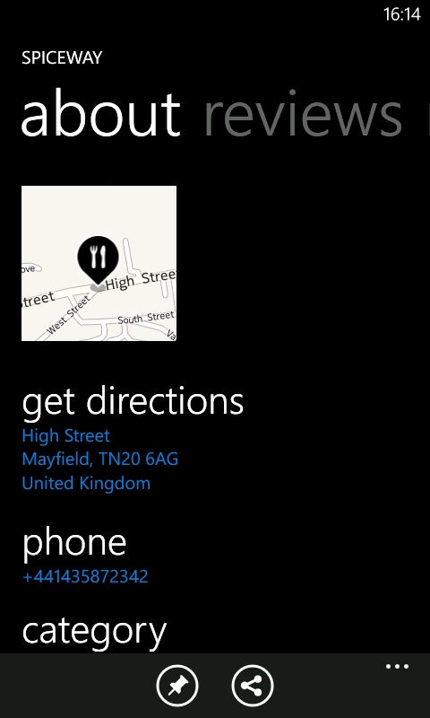
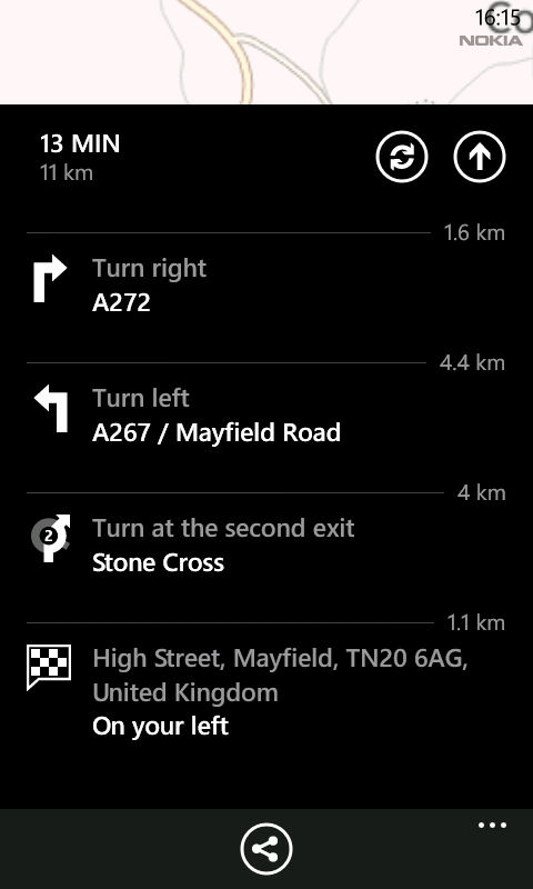
In any of the view tapping on a place brings up the information screen (place screen), from which additional details, reviews and directions from your current location can be accessed. The place pages, related information and directions are provided by the Nokia Maps app, a good example of app integration and clever cross linking.
City Lens works best is the urban environment, where the density of places means it can be used as both a discovery tool, but also to identify nearby places (what's the museum over there?) and to provide visual navigation over the last 100 metres (helps, in particular, with orientation). The integration with Nokia Maps provides a much needed link between discovery and navigating to the place in the real and while similar functionality can be found in Windows Phone's built in Local Scout, City Lens provides a more intuitive user experience and a bigger database of places.
Nokia City Lens Beta can be downloaded from the Windows Phone Marketplace. It is available for the Nokia Lumia 710, 800 and 900. It is currently not available for non-Nokia Windows Phone devices and will not work on the Nokia Lumia 610 (no compass). You can download the app by scanning the QR code on this page, using the direct download link in the AAWP app, or visiting betalabs.nokia.com on your phone.