There are two significant improvements to the traffic layer functionality. Firstly, more traffic information is now being displayed, both in terms of the number of roads covered, and the levels of congestion displayed. In addition to the existing red (severe congestion) and yellow (moderate congestion) lines, green lines are now displayed (free flowing traffic). This means there are lines overlaid on all roads for which traffic information is available, making it easier to plot a traffic free route.
Secondly the overlaid lines are clearer, being slightly thicker and smoother. This is especially notable on the higher resolution screen of the Nokia Lumia 920.
Incidentally, the traffic information is now the same as that displayed in Windows Phone default Maps app, something we discussed recently when looking at why you might choose the default Maps app over Nokia Maps.
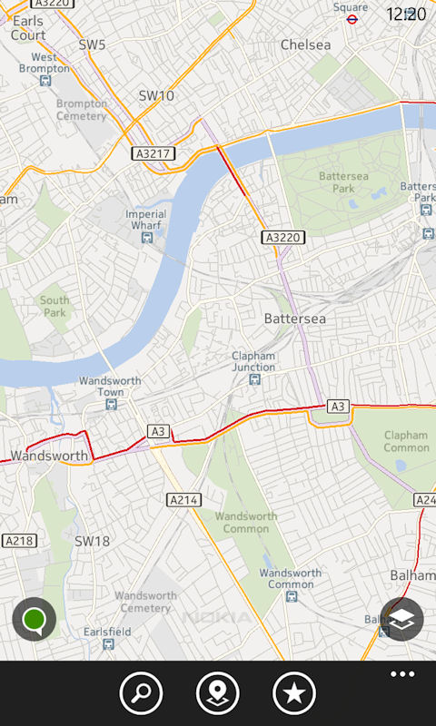
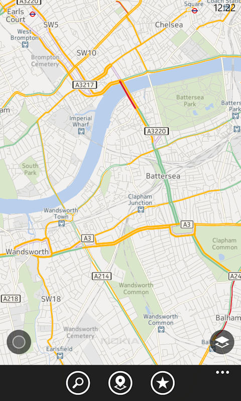
Nokia Maps traffic layer changes: previous version (left), new version (right)
The improved integration with Nokia Transport (also known as Nokia Transit) can be seen when selecting public transport as the navigation routing type (rather than car or walking). At the top of the direction a button, "get more results", has been added. Tapping this button will open the Nokia Transport app with the same route displayed.
This integration is an example of Windows Phone 8's new app-to-app communication feature. To the casual user it will appear that Nokia Transport is part of Nokia Maps, although in reality it's really a deep link between the two apps.
It's important to note that in order to take advantage of this new functionality you will also have to update the Nokia Transport app, which also had a new release today.

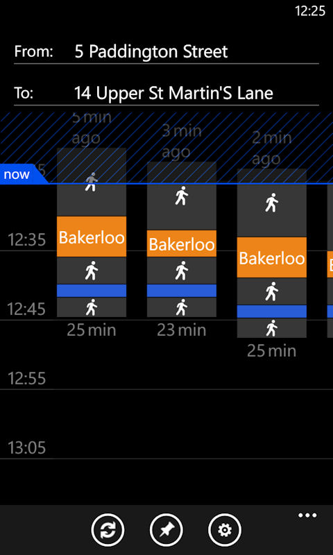
The obvious question is what are the reasons might you want to use Nokia Transport instead of the information displayed in Nokia Maps? The most obvious is that, in select cities, Nokia Transport provides schedule information, so that you can see when the next service is about to leave, and therefore time your journey accordingly. But other factors may include the fact that Nokia Transport offers multiple routes (where available), and the its clearer display of routing information (e.g. use of colour and icons).
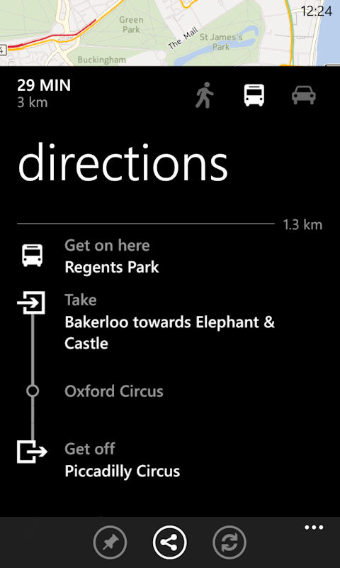
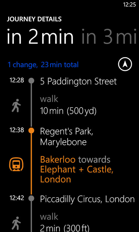
Display of route information in Maps and Transport respectively
As usual there are also a number of small bug fixes and performance improvements in the new version of Nokia Maps.
Windows Store description:
Whether you're someplace new or at a favourite haunt, Nokia Maps gives you new ways to discover the world around you, making you feel like a local wherever you go. Get reviews, uncover new places and reach them with smart routing for public transport, walking or driving. It’s more than a map; it's the world in your pocket.
Nokia Maps can be download from the Nokia collection in Windows Phone Store for free. It is only available for Nokia devices.