Review: GPS Calculator
Score:
79%
You've got to love a 'labour of love' utility that opens with a splash screen of a 'hungry chipmunk working tirelessly to start your app' - in this case GPS Calculator. Not quite what you might expect - rather than divulge the inner workings of your GPS satellite reception, it's more a mathematical aid, based around your position and around points on the Earth's surface. With widgets and calculation aids galore, and with a price of 'free', this is a must-download for orienteers and map-heads across the world.
Version Reviewed: 5.0
Buy Link | Download / Information Link

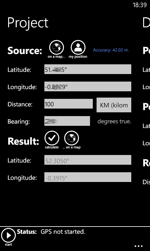
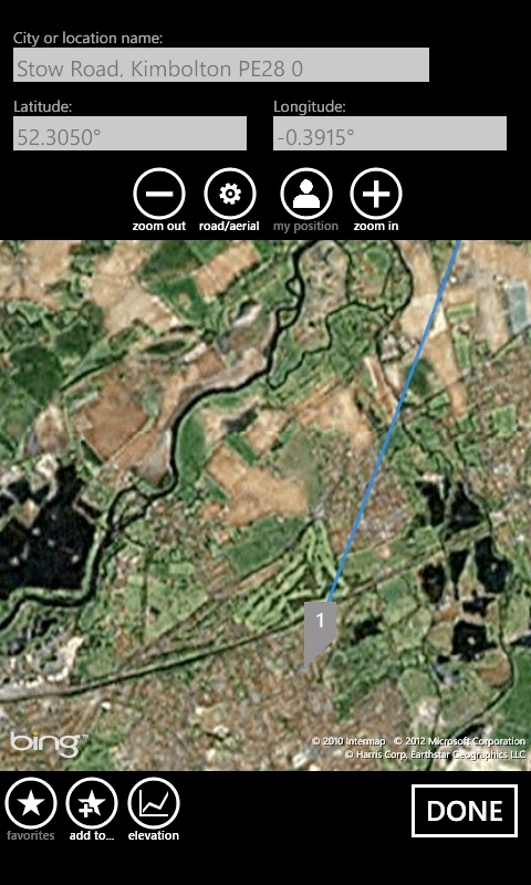
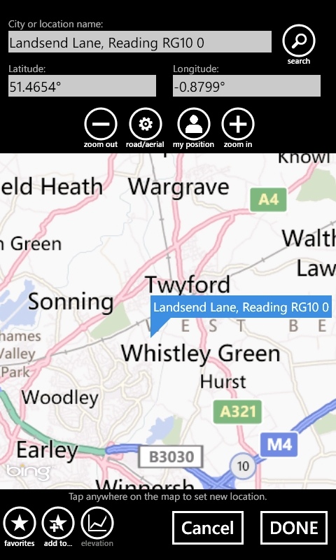
Your starting point (sic) with GPS Calculator (once you've 'started' the GPS, a process that's kept strictly manual to save power) is your own position, but it rapidly becomes apparent that leaps in other directions are involved, with an immediate prompt to enter a distance and bearing offset, upon which the resultant position is presented immediately and you can tap a button to see this on a map, either in road view or satellite view (courtesy of Bing Maps).
At any stage, a position can be marked as a 'Favourite' and given a name (e.g. 'Club hike basecamp'). The opening calculation is entitled 'Project' (as in projection of a vector from your current position?), but the Metro UI reveals a wealth of other calculations.
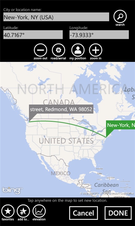
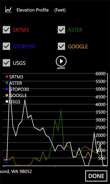
'Distance' calculates (as it sounds) the (Geodesic*, think 'as the crow flies') distance between two points on the Earth's surface that you specify, with the extra neat trick that the elevation along your journey (according to any of the sources shown in the screenshot below) can also be plotted (cool tip: pick a displacement that spans an ocean and watch the elevation dip to minus 3000m!)
* "Geodesic line is visualized on a world map and the shortest distance is accurately calculated using Vincenty’s formulae."
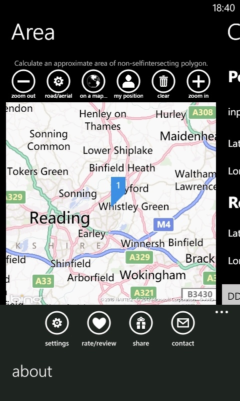
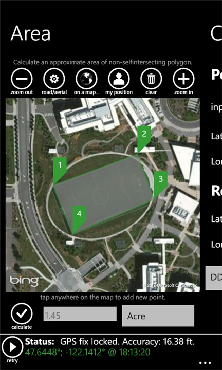
Swipe left again and you get the even cooler 'Area', nowhere near as boring as it sounds. Either on the satellite or road map, simply pick any number of points you want that border any area and GPS Calculator draws in a polygon to join the dots and then calculates the area contained, in hectares.
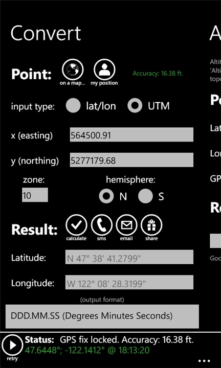
Swipe again and there's 'Convert', a (not so simple) converter between latitude/longitude and UTM (Universal Transverse Mercator) coordinates. As a Brit, I was disappointed not to see our national OS Grid northings and eastings as well, but then there are plenty of web-based converters for that slightly simpler calculation.
Impressively, the 'Convert' module also provides a quick way to share your exact position with others, by SMS, Email or via any of your Windows Phone-installed social networks. It would have been nice to have had this full set of sharing buttons in the other modules and to have had this functionality highlighted a bit more.
'Altitude' gets your approximate elevation from both GPS and from Google Maps topography APIs - apparently I'm 50m above sea level.
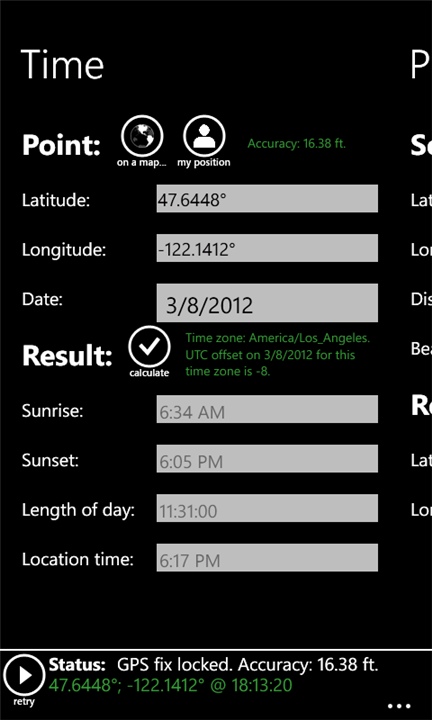
Finally, 'Time' (in theory) looks up the sunrise and sunset times for either any location on the map (or from coordinates, of course) or for your current position. Curiously, it didn't work from my home - maybe I'm destined not to see the sun today! The calculation worked fine for ad-hoc locations though.
Many of the functions above are internal to GPS Calculator and thus will work even without a data connection, but (obviously) some do need Internet access. Still, good to see as much offline use as possible, especially if you're out and about on the hills and with patchy or expensive data.
GPS Calculator is still being actively updated and well worth installing and watching. Even if you just fall in love with the cute opening (and, thankfully non-singing) chipmunk...
Reviewed by Steve Litchfield at